| Route 66 | Cities | Beaches |
|
|
Knife River Indian Village |
Fort Benton |
Enchanted Highway |
| This is one of the more challenging and entertaining days of the trip, rather like a North Dakota scavenger hunt. You will develop the definite suspicion these people do not want anyone here. You are told there will be signs. They're not here. When you do find signs, they have different routes on them than what you were told. There are right turns where you were told the road goes left. Sometimes there are roads where your map says there are none, and other times there are no roads where your map shows a major intersection. So just keep your sense of humor, use your map and compass skills, think carefully, and pay attention to details. Remember you have to find your way back so turn around at key intersections and make sure you know what it looks like going the other way. The Petrified Forest drive is only 10 miles from the Medora Visitor Center, so don't get discouraged. If you're staying at the Buffalo Gap Ranch, you still need to drive into Medora, because the exit off the interstate is only from the East. So while you're in Medora, you may as well stop at the Visitor Center and check for last minute information. | 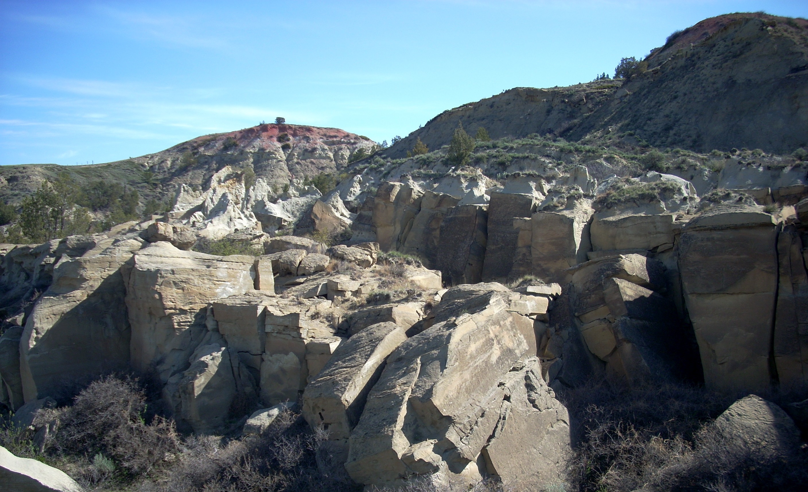 |
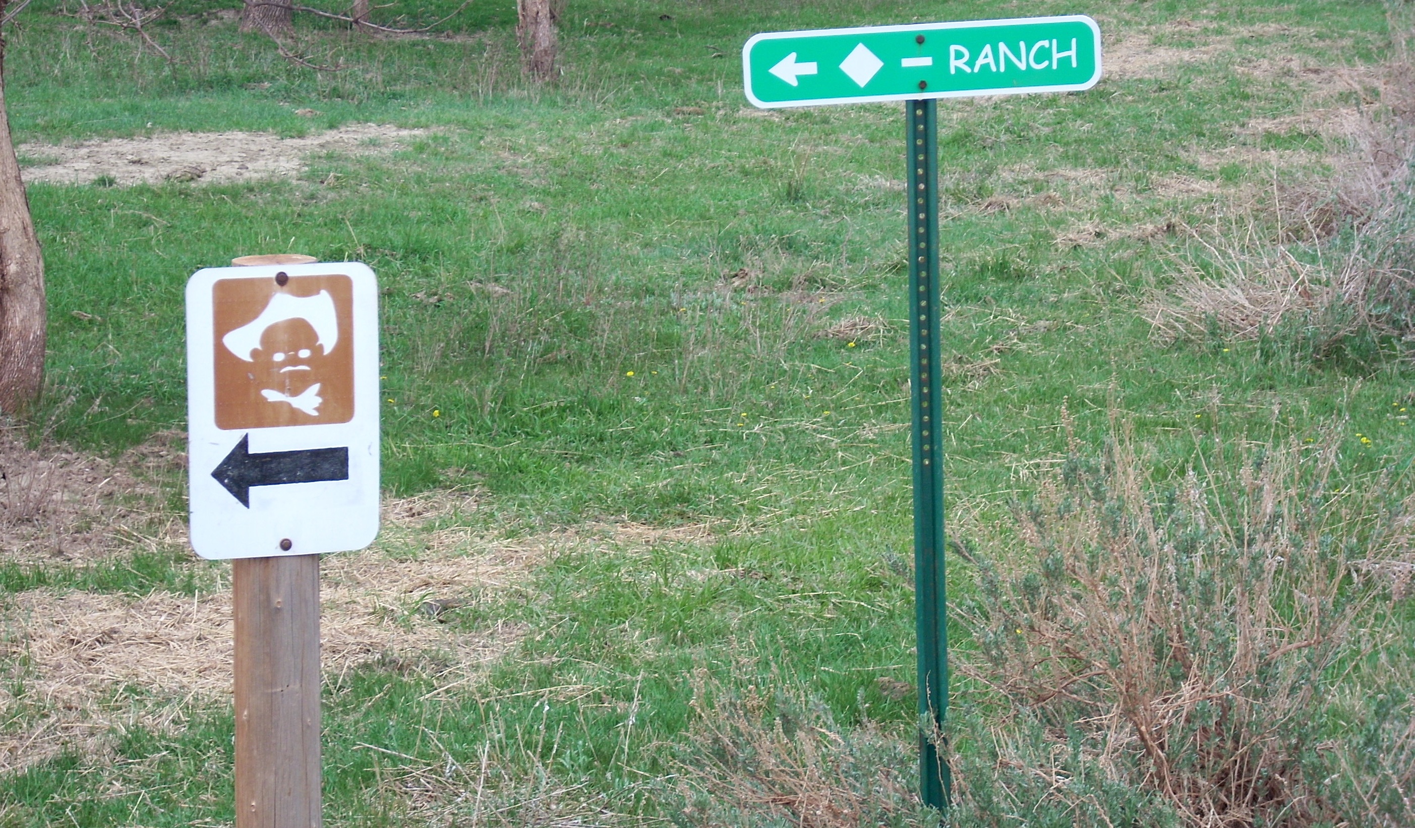 |
Coming out of Medora, get back on I-94 heading West at Exit 24. Go just over the hill and turn off at Exit 23. This places you on County Route 703A, an unpaved road. After about four miles, look for a left turn where the sign tells you the Myers Ranch is straight ahead and another sign tells you the Diamond Bar Ranch is to the left. Look for the little white sign with the brown square and Teddy Roosevelt head with black arrow. Turn left here. You'll see a fourth sign tell you turning left is forbidden, anyone driving on this road is guilty of trespassing, etc. Juat ignore that. As a park service user, the rancher has given you permission to use his road. |
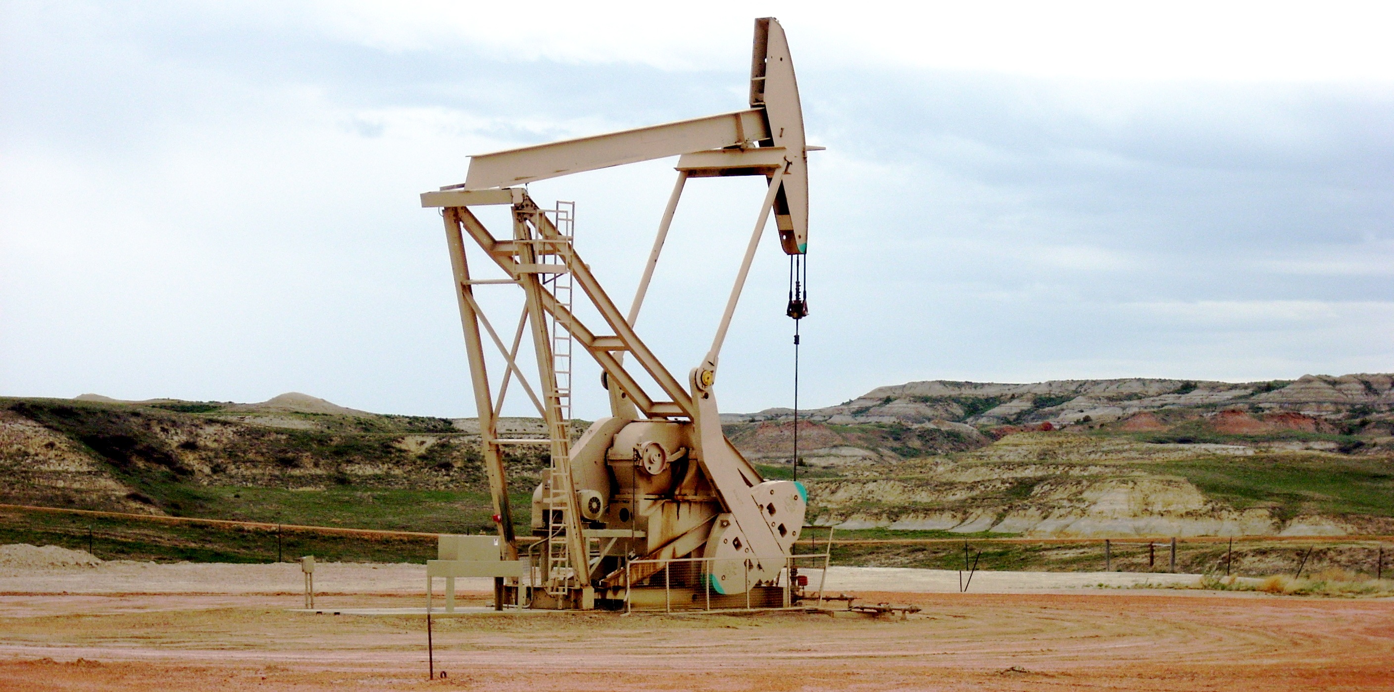
You're going to continue on Route 730 for three more miles. When you pass this "grass hopper" oil pump in a large fenced in pad to your right, slow down and pay attention. The road will drop briefly, then start coming back up. There is a right turn as it comes up the hill. |
 |
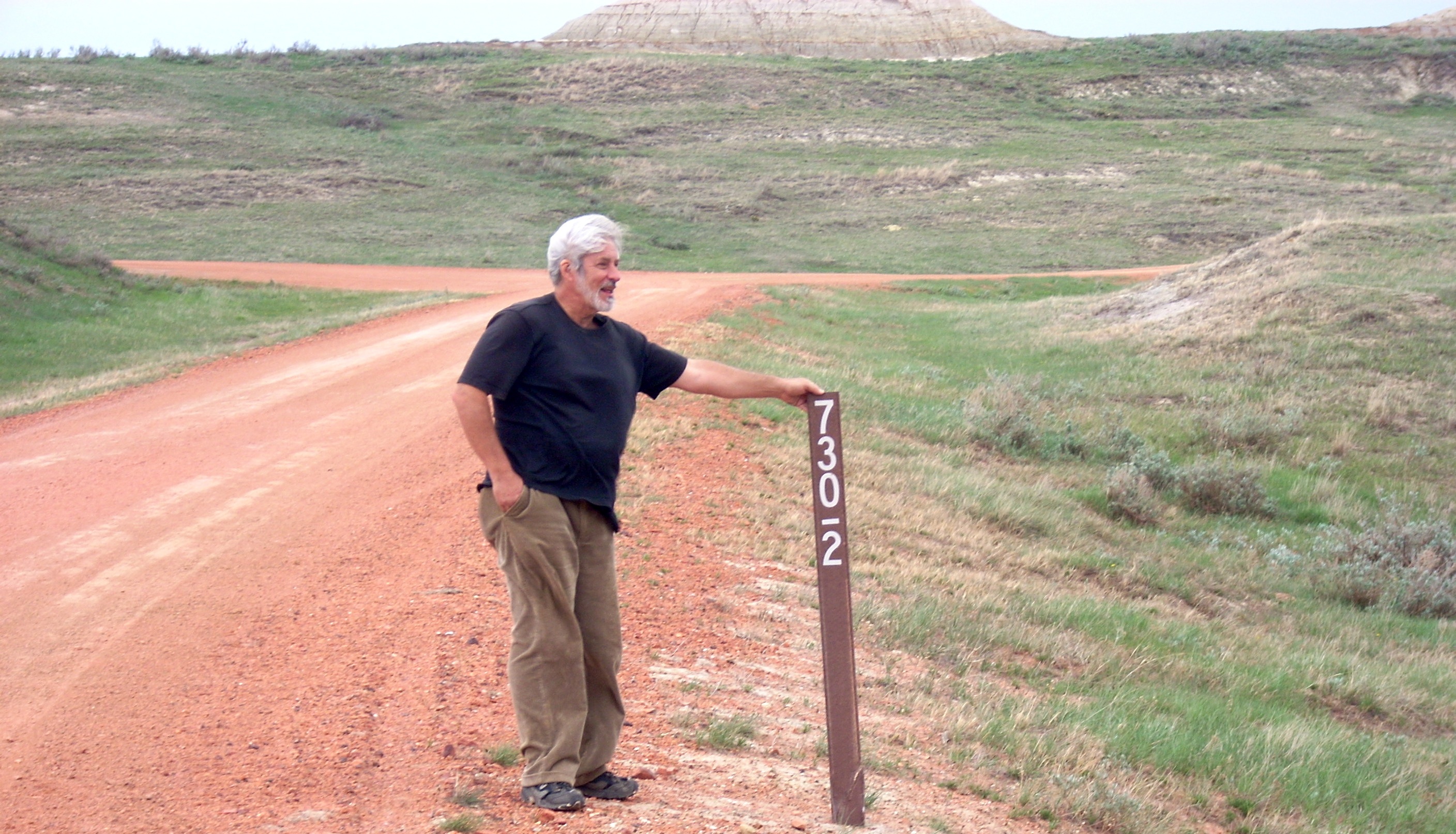 |
The road looks like this. The map says it is Route 7302. The sign agrees, with a line between the 0 and 2. The problem is we retrieved this sign from the weeds and held it up for this photo. By the time you get here, it may or may not be upright. So make the first right turn after the derrick, look for the sign laying on the ground, and use this photo as a check. Notice in the background Route 7302 veers right around the bend but a sideroad turns to the left. |
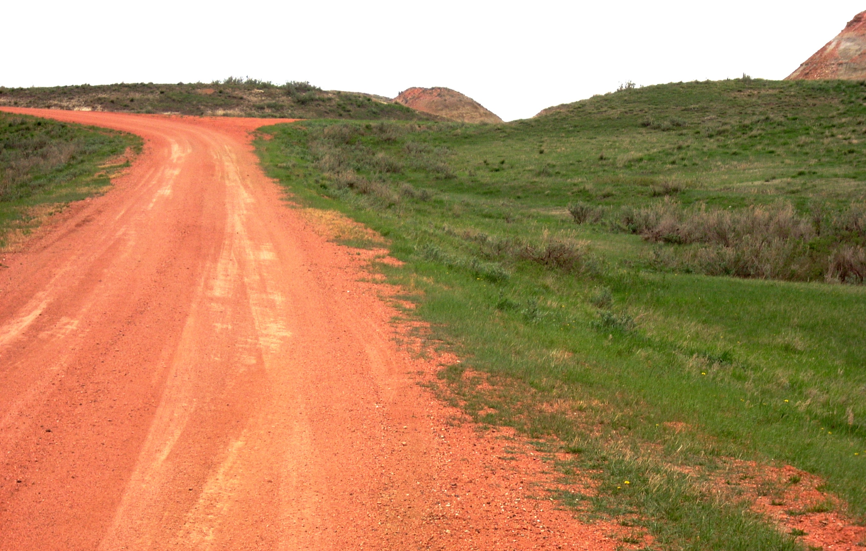
After you make that left turn, this is what the road looks like. Be careful. The map says this is County Route 7305. But the sign on the road says it is County Route 7303. You're going to crest that hill and drop into a deep valley. The road will swing to the right, straighten out, and after about half a mile dead end in a fenced in area holding oil facilities. Look to your left. You will see the scene below. Ease your vehicle off the main road down into this turnaround. Notice that signpost to the right of the road in the center of the photo. |
 |
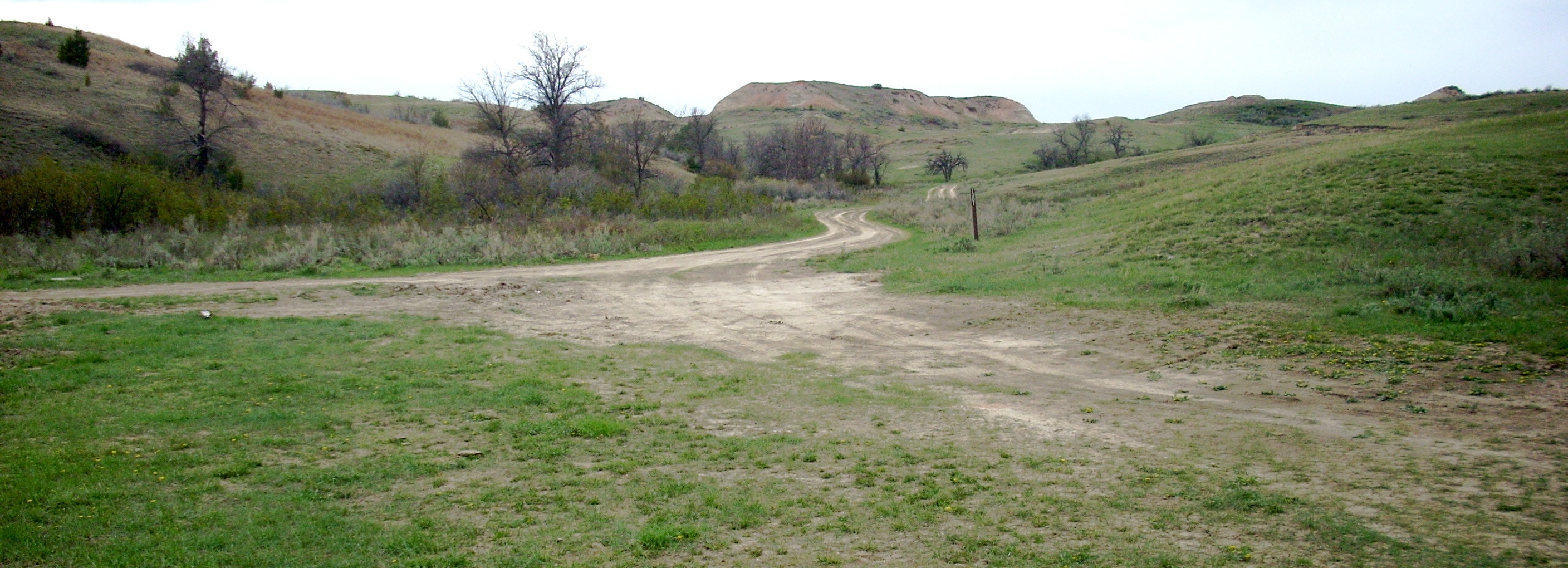 |
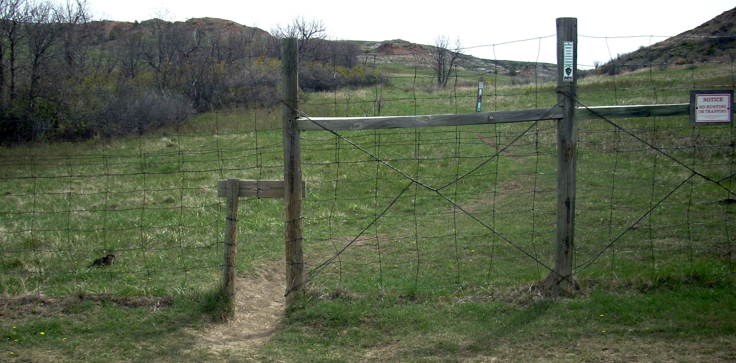
The sign says County Route 7301. You're going to follow it up the hill. This is where you may have trouble with center clearance. If you have to, you can park here and hike up the road for half a mile. The trailhead is just over the hill. You want to park at the TOP of the hill, well off the road, in the meadow to your left. There is a road that turns off to the right and drops down to the gate, but it is only two very deep ruts and there's no way most vehicles can clear the center. You can force your way down, but there's no way you'll ever get back up. |
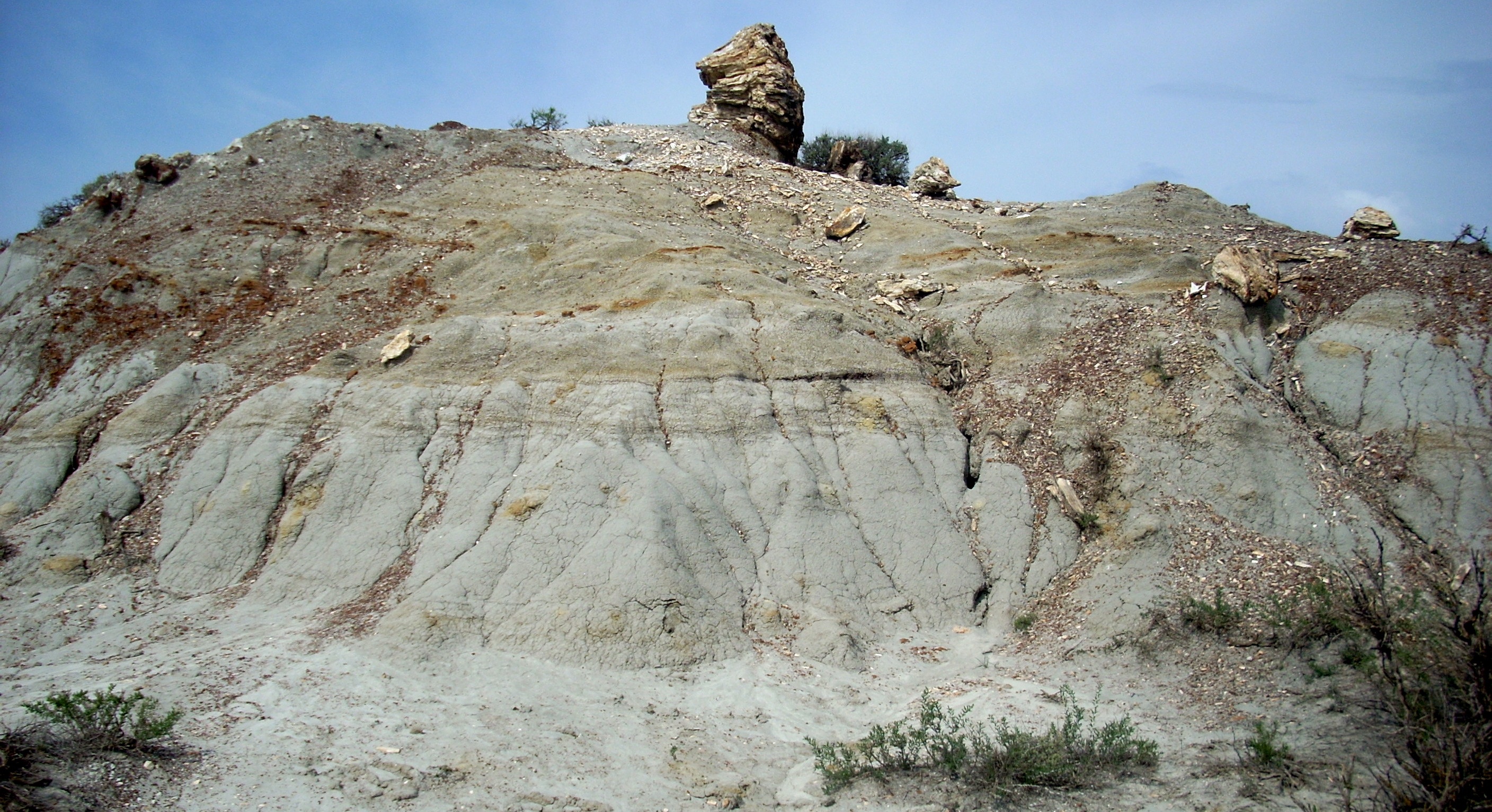
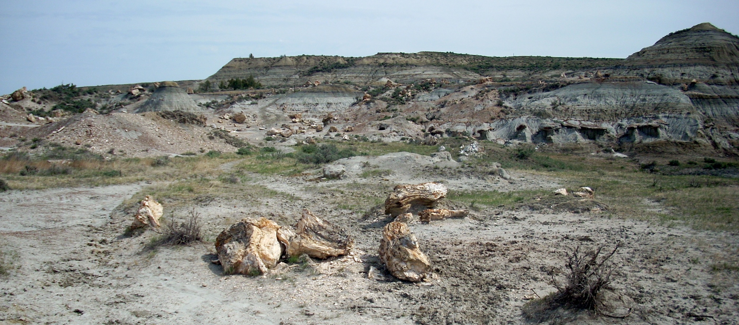
About a dozen vehicles a year have to be towed back up this hill, and there's no need for you to be next. The gate at right is what you'll see looking down that final hill. This is the national park boundary. You have been traversing the Little Missouri National Grassland, Myers Ranch, Buffalo Gap Ranch and Diamond Bar Ranch land on the way out from town. Do not come all the way out here, become worn out from the routefinding, and not hike the actual trail. The Petrified Forest is spectacular and unworldly and you owe it to yourself to go take a look. If you have to, just hike in using the left fork, see the first section, and come back out. That would be about a three mile round trip hike. |
 |
|
|||
|